
Sema Historical City
เมืองเสมา
Sema Historical City was constructed 1,500 years ago. This is a large ancient city from the period of 1400–1500 B.E. and is thought to have been the center of the Sri Canasapura Kingdom before the Khmer gained control of the E-sarn region. The kingdom was ruled by kings of the Phakkhathat dynasty who followed the Buddhist religion. This city was surrounded by an earthen moat. The city was built in 2 layers, referred to as the outer city and the inner city. The outer city was larger on the north side. Three ancient traces were found. In the center of the city was dug a square moat or pond; in the center is a round mound of earth. The inner city was surrounded by an earthen moat, with an uneven shape. Traces of the inner city are found at 6 sites. Some sites are religious centers of the Brahman religion, such as Prasat Prathan, constructed in Khmer style with bricks. Additionally, within the Mueang Sema skeletons were found buried ritually in the prostrate position wearing bronze rings along with pottery, iron tools, and glass beads.
เมืองเสมาก่อสร้างเมื่อราว 1,500 ปีมาแล้ว และเป็นเมืองโบราณขนาดใหญ่ในช่วง พ.ศ. 1400-1500 คาดว่าเป็นศูนย์กลางของอาณาจักรศรีจนาศะก่อนสมัยขอมเรืองอำนาจในดินแดนภาคอีสาน ปกครองโดยกษัตริย์แห่งราชวงศ์ภคทัตต์ที่นับถือศาสนาพุทธ ตัวเมืองมีคูน้ำคันดินล้อมรอบ ลักษณะการสร้างเมืองซ้อนกัน 2 ชั้น เรียกว่า เมืองนอกและเมืองใน เมืองนอกมีขนาดใหญ่กว่าอยู่ทางทิศเหนือ พบร่องรอยโบราณสถาน 3 แห่ง กลางเมืองขุดคูน้ำหรือสระรูปสี่เหลี่ยม มีเนินดินรูปวงกลมอยู่ภายใน ส่วนเมืองในมีคูน้ำคันดินล้อมรอบ รูปร่างไม่สม่ำเสมอ พบร่องรอยโบราณสถาน 6 แห่ง ซึ่งบางแห่งเป็นศาสนสถานในศาสนาพราหมณ์ เช่น ปราสาทประธานแบบเขมรก่อด้วยอิฐ ภายในเมืองเสมายังพบโครงกระดูกถูกฝังตามพิธีกรรมในท่านอนหงายเหยียดยาว สวมแหวนสำริด และพบภาชนะดินเผา เครื่องมือเหล็ก ลูกปัดแก้ว ฝังรวมอยู่ด้วย (khoratgeopark. ออนไลน์. 2562).
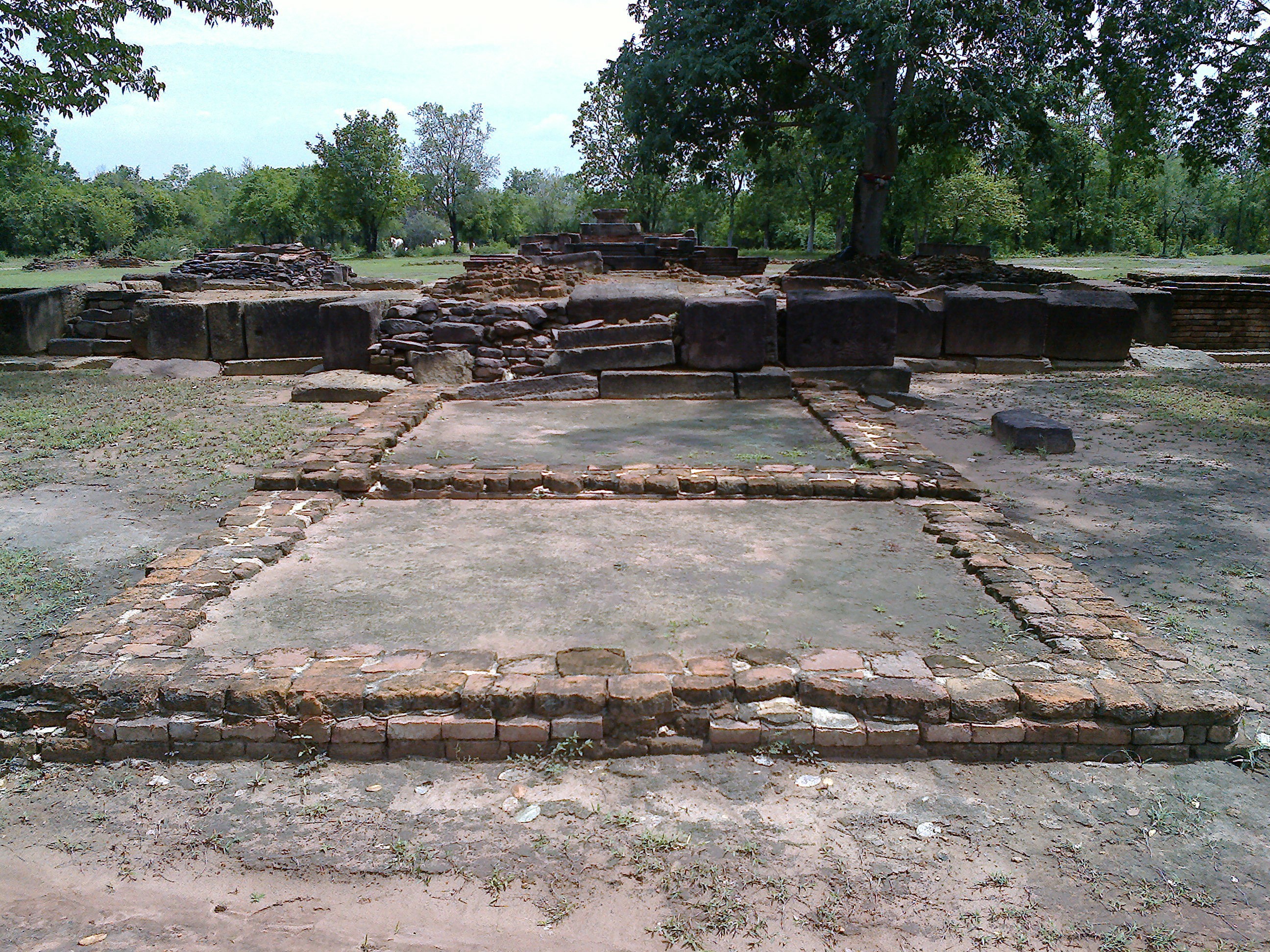
ภาพที่ 3.5 เมืองเสมา
ที่มา : ถ่ายเมื่อวันที่ 13 พฤษภาคม 2556 ณ เมืองเสมา อำเภอสูงเนิน จังหวัดนครราชสีมา.