Geotourism
การท่องเที่ยวเชิงภูมิศาสตร์ หรือจีโอทัวร์
Geotourism is defined as tourism that sustains or enhances the distinctive geographical character of a place-its environment, geology, heritage, aesthetics, culture and well-being of its residents (UNESCO, 2011 ; National Geographic, 2011; Geoworldtravel, 2011 cited in Khorat Geopark Office, 2020). Geotourism is a significant economic tool to develop economic and community, alleviate ways of living and increase income. Consequently, Geotourism has positive impact on national economic and society. It helps acknowledge local people about earth science and encourage their awareness for environmental conservation. Geotourism can also create a large number of job opportunities for locals and these examples are cultural performance show, increase in local product for sell, lectures and services. It assists in cultural and traditional preservation (Provincial Office of Nakhon Ratchasima. 2018).
การท่องเที่ยวเชิงภูมิศาสตร์หรือจีโอทัวร์ คือการท่องเที่ยวที่สนับสนุนหรือส่งเสริมลักษณะทางภูมิศาสตร์ที่โดดเด่น หรืออัตลักษณ์ของพื้นที่ ทั้งทางด้านสิ่งแวดล้อม ธรณีวิทยา สุนทรียภาพ มรดกและความเป็นอยู่ที่ดีของชุมชนที่อาศัยอยู่ โดยการท่องเที่ยวเชิงธรณีวิทยา (Geological Tourism) เป็นส่วนหนึ่งของการท่องเที่ยวเชิงภูมิศาสตร์ การท่องเที่ยวประเภทนี้มีความสำคัญโดยเป็นเครื่องมือในการพัฒนาเศรษฐกิจและสังคมของท้องถิ่น ช่วยยกระดับชีวิตความเป็นอยู่และรายได้ ทำให้เศรษฐกิจและสังคมในท้องถิ่นดีขึ้น ส่งผลดีต่อเศรษฐกิจและสังคมเชิงประชาชาติโดยรวม รวมถึงช่วยให้ชุมชนมีความรู้พื้นฐานทางด้านวิทยาศาสตร์โลกและร่วมเป็นเครือข่ายในการปกป้องสิ่งแวดล้อม นอกจากนี้การท่องเที่ยวจีโอทัวร์สามารถสร้างอาชีพให้ชุมชนในหลากหลายรูปแบบ เช่น การแสดงทางวัฒนธรรม การขายผลิตภัณฑ์ท้องถิ่น การนำเที่ยว การเป็นวิทยากร การให้บริการต่างๆ ทั้งยังเป็นการช่วยรักษาและสืบทอดวัฒนธรรมและประเพณีท้องถิ่นทางหนึ่ง
From the definition and significance of Geotourism, this type of tourism is related to visiting the attractions in environment, geology, culture and way of living in the community. Knowledge about paleontology is important in Geotourism management. This knowledge is related to distinctive feature and geographical information of geopark in Thailand in the following section.
จากนิยามและความสำคัญดังกล่าว การท่องเที่ยวเชิงภูมิศาสตร์หรือจีโอทัวร์เกี่ยวข้องกับการท่องเที่ยวไปยังแหล่งท่องเที่ยวที่มีความเกี่ยวพันทางด้านสิ่งแวดล้อม ธรณีวิทยา รวมถึงวัฒนธรรมความเป็นอยู่ที่มีชุมชนอาศัยอยู่กับพื้นที่อุทยานธรณีที่มีอยู่ในประเทศไทย ดังนั้น ความรู้ที่เกี่ยวข้องกับลักษณะโดยทั่วไปของอุทยานธรณีจึงเป็นข้อมูลที่มีความสำคัญยิ่งในการจัดการท่องเที่ยวเชิงภูมิศาสตร์ ซึ่งความรู้นี้เกี่ยวข้องกับลักษณะเฉพาะ และลักษณะทางภูมิศาสตร์ของอุทยานธรณีในประเทศไทยมีดังต่อไปนี้
Geopark in Thailand อุทยานธรณีในประเทศไทย
Geopark is an area with distinctive geology, nature and culture with narrative connected to value of the earth and way of living. This area is collaboratively managed by all nearby communities through protection, education and sustainable development.
อุทยานธรณี คือ พื้นที่ที่มีความสำคัญและโดดเด่นทางธรณีวิทยา ธรรมชาติวิทยา และวัฒนธรรม มีเรื่องราวที่เชื่อมโยงคุณค่าของผืนแผ่นดินกับวิถีชีวิตชุมชนที่อาศัยอยู่ในพื้นที่ซึ่งมีการบริหารจัดการแบบมีส่วนร่วมของทุกภาคส่วน โดยการอนุรักษ์ การศึกษา และการพัฒนาอย่างยั่งยืน (Khorat Geopark Office. 2019).
There are 3 local Geoparks in Thailand 2 National Geopark and 1 UNESCO Global Geoparks. These Geoparks are located in the northern, the north eastern and the southern region in Thailand. The most distinctive is Satun UNESCO Global Geopark and also a National Geopark. The other 2 are National Geoparks: Khorat Geopark and Phachan-Samphanbok Geopark located in north eastern region in Thailand. The other 3 are Local Geoparks: Tak Geopark and Petchabun Geopark in the northern region of Thailand, and Khon Kaen Geopark in the north eastern region of Thailand. Brief information of these well-known Geoparks in Thailand is presented in following section.
ประเทศไทยมีอุทยานธรณีระดับท้องถิ่น 3 แห่ง ระดับชาติ 2 แห่ง และระดับโลก 1 แห่ง โดยที่อุทยานธรณีเหล่านี้ตั้งอยู่ในภาคเหนือ ภาคตะวันออกเฉียงเหนือ และภาคใต้ อุทยานธรณีที่โดดเด่นที่สุดคืออุทยานธรณีสตูลที่เป็น UNESCO Global Geopark และเป็นอุทยานธรณีแห่งชาติ อุทยานธรณีที่เหลือเป็นอุทยานธรณีประเทสไทย 2 แห่งตั้งอยู่ในภาคตะวันออกเฉียงเหนือของประเทศไทย อันมี อุทยานธรณีโคราชและอุทยานธรณีผาชัน สามพันโบก ส่วนอีก 3 แห่งเป็นอุทยานธรณีท้องถิ่นคืออุทยานธรณีตาก และเพชรบูรณ์อยู่ในภาคเหนือของประเทศไทย ตั้งอยู่ในภาคตะวันออกเฉียงเหนือคือ อุทยานธรณีขอนแก่น ส่วนต่อไปจะนำเสนอข้อมูลโดยย่อของอุทยานธรณีเหล่านี้ในประเทศไทย
In the north of Thailand, 2 main Geoparks are Petchabun Geopark and Tak Geopark. Petchabun Geopark is located in Petchabun Province by its’ name and has a total of 21 geosites. The second geopark-Tak Geopark is located in Tak Province and covers the large area of 6,000 square kilometer with a total 20 geosites to visit.
ในภาคเหนือของประเทศไทยมีอุทยานธรณีหลัก 2 แห่งคือ อุทยานธรณีเพชรบูรณ์ และ อุทยานธรณีตาก ซึ่งมาจากชื่อจังหวัดที่อุทยานธรณีเหล่านี้ตั้งอยู่ อุทยานธรณีเพชรบูรณ์มีแหล่งธรณีวิทยาทั้งหมด 21 แห่ง อุทยานธรณีแห่งที่สอง คืออุทยานธรณีตาก ตั้งอยู่ในจังหวัดตาก และครอบคลุมพื้นที่ขนาดใหญ่ 6,000 ตารางกิโลเมตร ที่มีแหล่งธรณีวิทยาทั้งหมด 20 แห่ง
In the south of Thailand, the only national and UNESCO Global Geopark is Satun UNESCO Global Geopark. It is located in Satun Province with a total area of 2,597 square kilometer and a total of 27 geosites, 15 natural and cultural sites.
ทางตอนใต้ของประเทศไทยมีอุทยานธรณีระดับโลกเพียงแห่งเดียวที่ได้รับการรับรองจาก UNESCO และ เป็นอุทยานธรณีแห่งชาติด้วย คือ อุทยานธรณีสตูล ซึ่งตั้งอยู่ในจังหวัดสตูล มีพื้นที่ทั้งหมด 2,597 ตารางกิโลเมตร และมีแหล่งธรณีวิทยารวมทั้งสิ้น 27 แห่ง ประกอบด้วยแหล่งท่องเที่ยวทางธรรมชาติและวัฒนธรรม 15 แห่ง
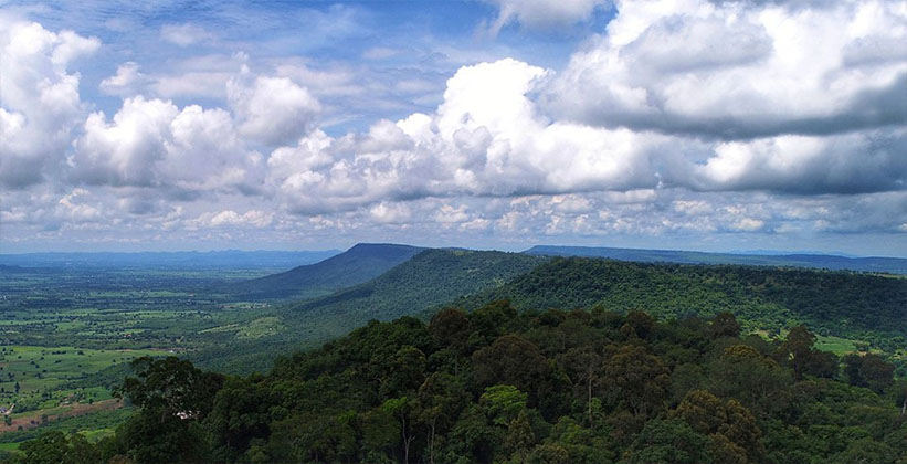
In the north-eastern part of Thailand, there are 3 major Geoparks. The first one is Phachan-Samphanbok Geopark. It is located in Ubon Ratchathani Province and covers the area of 1,714 square kilometer with a total of 38 geosites to visit. The site has been announced as a geoheritage site with Stratigraphy and Paleo-Environment research. Ministry of Natural Resources and Environment announced this geopark as National Geopark on 22 September, 2019. The second one is Khon Kaen Geopark and located in this province from the name. It covers the area of 1,733 square kilometer with a total of 23 geosites to visit. The last geopark is Khorat Geopark, the site of interest in this unit. Khorat Geopark will become Global Geopark and will be recognized as a UNESCO Triple Crown-1 of the 3 sites in the World along with South Korea and China. From this global significance, information of Khorat Geopark, its’ identity and World Paleontopolis/Fossils City, Cuesta and Fossil Land and Geotourism routes are covered in the following section (Nakhon Ratchasima Rajabhat University. 2018).
ภาคตะวันออกเฉียงเหนือของประเทศไทยมีอุทยานธรณีสำคัญ 3 แห่ง แห่งแรกคือ อุทยานธรณีผาชัน สามพันโบก ตั้งอยู่ในจังหวัดอุบลราชธานี และครอบคลุมพื้นที่ 1,714 ตารางกิโลเมตร มีแหล่งธรณีวิทยาให้เข้าชมทั้งหมด 38 แห่งถือเป็นแหล่งมรดกทางธรณีวิทยาที่มีงานวิจัยด้านธรณีศาสตร์ด้านลำดับชั้นของหิน และสภาพแวดล้อมบรรพกาล กระทรวงทรัพยากรและสิ่งแวดล้อมรับรองเป็นอุทยานแห่งชาติเมื่อวันที่ 22 สิงหาคม 2562 อุทยานธรณีแห่งที่สองคือ อุทยานธรณีขอนแก่น ตั้งอยู่ในจังหวัดนี้จากชื่อที่ตั้ง ครอบคลุมพื้นที่ 1,733 ตารางกิโลเมตร มีแหล่งธรณีวิทยาทั้งหมด 23 แห่ง ให้เยี่ยมชมถือเป็นแหล่งมรดกทางธรณีวิทยา อุทยานธรณีแห่งสุดท้ายคือ อุทยานธรณีโคราชกำลังดำเนินการก้าวไปสู่อุทยานธรณีโลกของยูเนสโก และเมื่อถึงตอนนั้นก็จะได้รับการยอมรับโดยทั่วไปว่าเป็น UNESCO Triple Crown ซึ่งเป็น 1 ใน 3 แห่งในโลก ถัดจากสาธารณรัฐเกาหลีและสาธารณรัฐประชาชนจีน มีพื้นที่ 3,167 ตารางกิโลเมตร มีแหล่งธรณิทยา 24 แห่ง แหล่งธรรมชาติอื่นและแหล่งวัฒนธรรมรวม 15 แห่ง จังหวัดนครราชสีมาประกาศเป็นอุทยานธรณีเมื่อวันที่ 29 กันยายน 2558 กระทรวงทรัพยากรและสิ่งแวดล้อมรับรองเป็นอุทยานแห่งชาติเมื่อวันที่ 24 สิงหาคม 2561 จากความสำคัญระดับโลกของข้อมูลของโคราชจีโอพาร์ค เนื้อหาส่วนต่อไปจะได้นำเสนอเอกลักษณ์มหานครแห่งบรรพชีวิน ดินแดนแห่งเขาเควสตา ฟอสซิล และเส้นทางการท่องเที่ยวเชิงภูมิศาสตร์
In summary, significant and distinctive geological features of 6 geoparks are as follows.
1. Satun UNESCO Global Geopark is distinctive in fossil land with 6 Paleozoic eras.
2. Khorat Geopark is distinctive in Cuesta and fossil land.
3. Phachan-Samphanbok Geopark is distinctive in pothole and escarpment.
4. Khon Kaen Geopark is distinctive as land of Phu Wiang Dinosaur.
5. Tak Geopark is distinctive as land of the largest and longest petrified woods.
6. Petchabun Geopark is distinctive as land with 2 connecting terranes, Indochina Terrane and Sinermas Terrane.
โดยสรุปลักษณะทางธรณีวิทยาที่สำคัญและโดดเด่นของอุทยานธรณีทั้ง 6 แห่งมีดังนี้
1. อุทยานธรณีสตูลมีลักษณะเด่นคือเป็นดินแดนแห่งฟอสซิลพาลีโอโซอิกครบทั้ง 6 ยุค
2. อุทยานธรณีโคราชมีลักษณะเด่นคือเป็นดินแดนแห่งเขาเควสตาและฟอสซิล
3. อุทยานธรณีผาชันสามพันโบกมีลักษณะเด่นคือเป็นดินแดนแห่งกุมภลักษณ์และผาอัศจรรย์
4. อุทยานธรณีขอนแก่นมีลักษณะเด่นคือเป็นดินแดนไดโนเสาร์แห่งหุบเขาภูเวียง
5. อุทยานธรณีไม้กลายเป็นหินตากมีลักษณะเด่นคือเป็นดินแดนแห่งฟอสซิลไม้กลายเป็นหินที่มีขนาดใหญ่และยาวที่สุดในโลก
6. อุทยานธรณีเพชบูรณ์มีลักษณะเด่นคือเป็นดินแดนเชื่อมอนุทวีปทั้ง 2 แห่งที่แตกต่างกัน คือ ทวีปอินโดจีนและทวีปไซเนอมาสุ

อุทยานธรณีผาชันสามพันโบก